최대 해상도입니다.
Enchanted_rock_2006.jpg (640 × 480 픽셀, 파일 크기: 59 KB, MIME 종류: image/jpeg)
파일 설명
|
This is an image of a place or building that is listed on the National Register of Historic Places in the United States of America. Its reference number is 84001740. |
| 설명 |
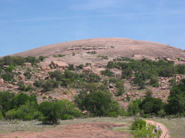
Enchanted Rock as viewed from the trail leading to the summit. People climbing on the summit (visible as dots) give an idea of the scale of the granite rock. Source: Photo taken by uploader, April 14, 2006. |
| 날짜 | 2006년 4월 18일 (원본 올리기 일시) |
| 출처 | en.wikipedia에서 공용으로 옮겨왔습니다. |
| 저자 | 영어 위키백과의 Claygate |
| 대상 위치 | | 이 지역의 다른 사진을 보기: OpenStreetMap |
|---|
라이선스
| 이 작품은 저작자인 영어 위키백과의 Claygate에 의해 퍼블릭 도메인으로 공개된 작품입니다. 이 공개 선언은 전 세계적으로 유효합니다. 만약 저작권의 포기가 법률적으로 가능하지 않은 경우, Claygate은 이 작품을 법적으로 허용되는 한도 내에서 누구나 자유롭게 어떤 목적으로도 제한 없이 사용할 수 있도록 허용합니다. |
기존 올리기 기록
The original description page was here. All following user names refer to en.wikipedia.
- 2006-04-18 01:13 Claygate 640×480×8 (60062 bytes) Picture taken by uploader, April 14, 2006.
파일 역사
날짜/시간 링크를 클릭하면 해당 시간의 파일을 볼 수 있습니다.
| 날짜/시간 | 섬네일 | 크기 | 사용자 | 설명 | |
|---|---|---|---|---|---|
| 현재 | 2007년 4월 24일 (화) 11:04 | | 640 × 480 (59 KB) | wikimediacommons>Jomegat | {{Information |Description=Enchanted Rock as viewed from the trail leading to the summit. People climbing on the summit (visible as dots) give an idea of the scale of the granite rock. Source: Photo taken by uploader, April 14, 2006. |Source=Originally f |